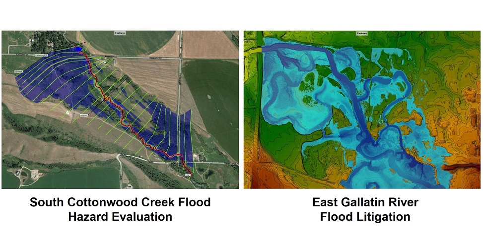
South Cottonwood Creek Flood Hazard Evaluation & East Gallatin River Flood Litigation
Hydaulic models of both South Cottonwood Creek (1-D) and the East Gallatin River (2-D) were developed to conduct an independent flood hazard evaluation of the proposed sites. This included evaluating hydraulic conditions of the study area such as roughness coefficients, hydraulic structure (bridge and culvert) openings, and channel and floodplain condition, and performing hydraulic analysis using U.S. Army Corps of Engineering Hydrologic Engineering Center's River Analysis System (HEC-RAS) software to evaluate flood risk for the 10-, 25-, 50-, and 100- and 500-year flood profiles.
Work was completed under subcontract to HydroSolutions.
Project Details
Client: Private Landowners
Date: TBD
Tag: flood hazard evaluation, litigation